Greg Tieman at ArcGIS blog writes about new functionalities in ArcGIS Analytics for IoT that has been renamed to ArcGIS Velocity.
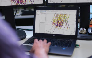
ArcGIS Velocity allows organizations to ingest, visualize, analyze, and act on data from sensors. It also enables the processing of high-volume historical data to gain insights into patterns, trends, and anomalies. Remote monitoring of assets, predictive maintenance, and process optimization are a few of the benefits you can gain from your IoT data.
At this release, ArcGIS Analytics for IoT has been renamed to ArcGIS Velocity to more broadly encompass the capabilities for working with real-time and big data at scale. ArcGIS Velocity is updated regularly, below is a quick overview of some highlights in the October 2020 release:
- General – Three new license levels, enabling powerful real-time and big data analysis across different tiers of data velocity and volume.
- Feeds and data sources – Feeds consume significantly less compute for equivalent velocities of processing.
- Outputs – Standardized datetime representation across delimited, Feature JSON, and GeoJSON output data formats.
- Analytics – Validation and data management enhancements for output feature layers.
Now, let’s take a deeper dive into each of these exciting enhancements!
General
We are excited to announce three new license levels for ArcGIS Velocity that will enable your organization with powerful real-time and big data analysis across different tiers of data velocity and volume. The new license levels are Standard, Advanced, and Dedicated. The following table summarizes the general functionality of each license level. For all the details, see ArcGIS Velocity Licensing.

Feeds and data sources
A feed is a real-time stream of data coming into ArcGIS Velocity while a data source loads stored data for use in a real-time or big data analytic. Integrating with industry standard data and messaging platforms is one of the key capabilities of Velocity. With this release, several key enhancements have been made to feeds and data sources, including:
- Feeds now consume significantly less compute for equivalent velocities of processing. This means organizations with the Dedicated license level can run more items within their subscription capacity.
- Feeds are now automatically displayed in an embedded map widget on the Feed details page, allowing you the ability to immediately confirm if data is being ingested as expected. If the data is not appearing in the map widget, you can revisit the feed configuration to address any issues.
- Feeds now display the start time of the current run on the Details page.
- Enhancements to the RSS feed and data source type to support user-defined headers. This broadens the options for configuring RSS data ingestion from different industry APIs.
Outputs
An output is a result or action to be taken as the final step in a real-time or big data analytic. Analytics can emit data to a variety of different destinations, including storing data to a feature layer, sending an email, writing to a cloud store, and pushing to a third-party system for device actuation. New at this release are several enhancements to outputs, including:
- Output data formats for delimited, Feature JSON, and GeoJSON were standardized so that datetime representation is consistent across all data formats.
- Logging improvements have been made to the HTTP and feature layer outputs, allowing you to more easily troubleshoot when destination endpoints or feature layers are not reachable.
Analytics
The power of ArcGIS Velocity can be realized in the real-time and big data analytic capabilities that can be performed on your IoT data. With this release, several enhancements are available including:
- Validation and data management enhancements for output feature layers, including improving data load performance for big data analytics.
- User interface enhancements, allowing you to select and move multiple node elements in model view.
- Analytics now display the start time of the current run on the Details page.
And more…
In addition to the existing options for visualizing your IoT data, new rendering capabilities were added for output map image layers. When rendering raw features, unique value rendering is now supported for varying symbols based on an attribute. Additionally, class break rendering now supports over 300+ color ramps.
And lastly, improvements have been made to the ArcGIS Velocity app cross-browser functionality, localization, and internationalization.